2024 Field Season Victoria Fjord Northern Greenland

KANGERTITTIVAQ (SCORESBY SUND) SUMMER FIELDWORK 2022
Kangertittivaq was the location for 2022 field work. Located in East Greenland just south of the large wildlife protected are Northeast Greenland National Park, Kangertittivaq is the largest fjord system in the world. The main fjord channel is ~110 km long but the extensive network of fjords includes some that extend much longer, up to 350 km, and reach depths of 1,450 m. Small islands are found throughout the fjords. Access to the field area for the team was through a small airport at Nertlerit Inaat (Constable Pynt). Slide through the photos for a sense of our field season.
Image Carousel with 22 slides
A carousel is a rotating set of images. Use the previous and next buttons to change the displayed slide
-
Slide 1: PhD student Karlee Prince samples a large glacial erratic in Kangertittivaq
-
Slide 2: A glacial erratic, rock depositied by ice as it retreated to a new position, is perfect for exposure dating to determine an age of retreat
-
Slide 3: Glacier flowing out the mouth of the fjord pulling sediment as it moves over the landscape
-
Slide 4: Glacial erratics deposited by the retreating ice sheet down in the bed of the fjord
-
Slide 5: Graduate students Liza Wilson (l) and Karlee Prince (r) drop in by helicopter to collect some samples
-
Slide 6: Joerg Schaefer collects a sample for exposure dating. The fjord peaks are rocky, with glacial erratics of many sizes left behind by the ice.
-
Slide 7: Graduate student Liza Wilson collects a sample of Polytrichum moss, a paleoclimate sampling proxy
-
Slide 8: The fjords are deep cut. The pen in the foreground provides a scale for the fjord bed.
-
Slide 9: Graduate student Liza Wilson is studying Polytrichum moss as a tool for understanding the movement of the ice sheet edge over time.
-
Slide 10: Team photo captured in the field (L-R) Jason Briner, U@B, Lead PI, Joerg Schaefer, LDEO, PI, Liza Wilson, U@B, Graduate student, Karlee Prince, U@B, PhD student
-
Slide 11: Sampling a series of perched lakes (in the left foreground) that sit at different elevations, can be used to understand ice retreat in this fjord valley
-
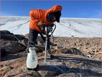
Slide 12: Blades on the hand drill are critical in cutting through large glacial erratics for rock samples to analyze back in the lab.
-
Slide 13: Joerg Schaefer, an LDEO PI, in Kangertittivaq
-
Slide 14: Karlee Prince, U@B PhD student records data coordinates after sample collection
-
Slide 15: Ittoqqortoormiit, a small community in East Greenland. This area has few small settlements. Like the rest of Greenland the people have settled on the coastline for access to resources. The helipad is visible in this image.
-
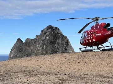
Slide 16: Mittarfik (Airport) Nerlerit Inaat in East Greenland, a small regional airport with an Air Greenland helicopter
-
Slide 17: Liza Wilson (r) collects a sample of polytrichum moss in a quick helicopter stop. Joerge Schaefer (l) and Karlee Prince (c)
-
Slide 18: This Greenland glacier has carved out a deep basin and as it retreated it left a channel of meltwater and glacial clay that had been ground down by the ice movement. Sediments from under the ice fill the channel and forms a sedimentary fan at the mouth.
-
Slide 19: Karlee Prince, U@B PhD student, in the cockpit of the small helicopter.
-
Slide 20: Liza Wilson, U@B graduate student, collects a rock sample for exposure dating.
-
Slide 21: Joerg Schaefer, LDEO, PI and Karlee Prince, U@B, PhD student examine a section of quartz
-
Slide 22: Liza Wilson, U@B graduate student, is sampling ice cap tundra for her Master’s project


 and Karlee Prince (r) drop in by helicopter to collect some samples")


 Jason Briner, U@B, Lead PI, Joerg Schaefer, LDEO, PI, Liza Wilson, U@B, Graduate student, Karlee Prince, U@B, PhD student")
 that sit at different elevations, can be used to understand ice retreat in this fjord valley")


 Nerlerit Inaat in East Greenland, a small regional airport with an Air Greenland helicopter")
 collects a sample of polytrichum moss in a quick helicopter stop. Joerge Schaefer (l) and Karlee Prince (c)")


Link to an image gallery from 2022 summer field sampling in NW Greenland to support both the GRate and the GreenDrill projects. Both projects focus on the contribution of the Greenland Ice Sheet to future global sea level, although GreenDrill is drilling through the ice to collect bedrock samples to look at past rock exposure.
Link to photo gallery of more images from summer 2022 work in East Greenland.
The GRate project is funded under the National Science Foundation Office of Polar Programs.